top of page

Billboard Locations:

SYLVA

SYL-3310-NO.1

SYL-3310-NO.1

SYLVA

Lat

35.323547

Long

-83.261733

Size:

10'5x22'8

Wkly DEC:

44100

Notes:

E/S US 441 S 4.5 Mi S/O US 74/23, S/F, Right Across from A-1 Storage

SYL-3310-SI.1

SYL-3310-SI.1

SYLVA

Lat

35.323547

Long

-83.261733

Size:

10'5x22'8

Wkly DEC:

44100

Notes:

E/S US 441 S 4.5 Mi S/O US 74/23, N/F, Right Across from A-1 Storage

SYL-3310-SO.1

SYL-3310-SO.1

SYLVA

Lat

35.323547

Long

-83.261733

Size:

10'5x22'8

Wkly DEC:

44100

Notes:

E/S US 441 S 4.5 Mi S/O US 74/23, N/F, Left Across from A-1 Storage

SYL-3396-E.1

SYL-3396-E.1

SYLVA

Lat

35.371367

Long

-83.20487

Size:

12'0x24'0

Wkly DEC:

154560

Notes:

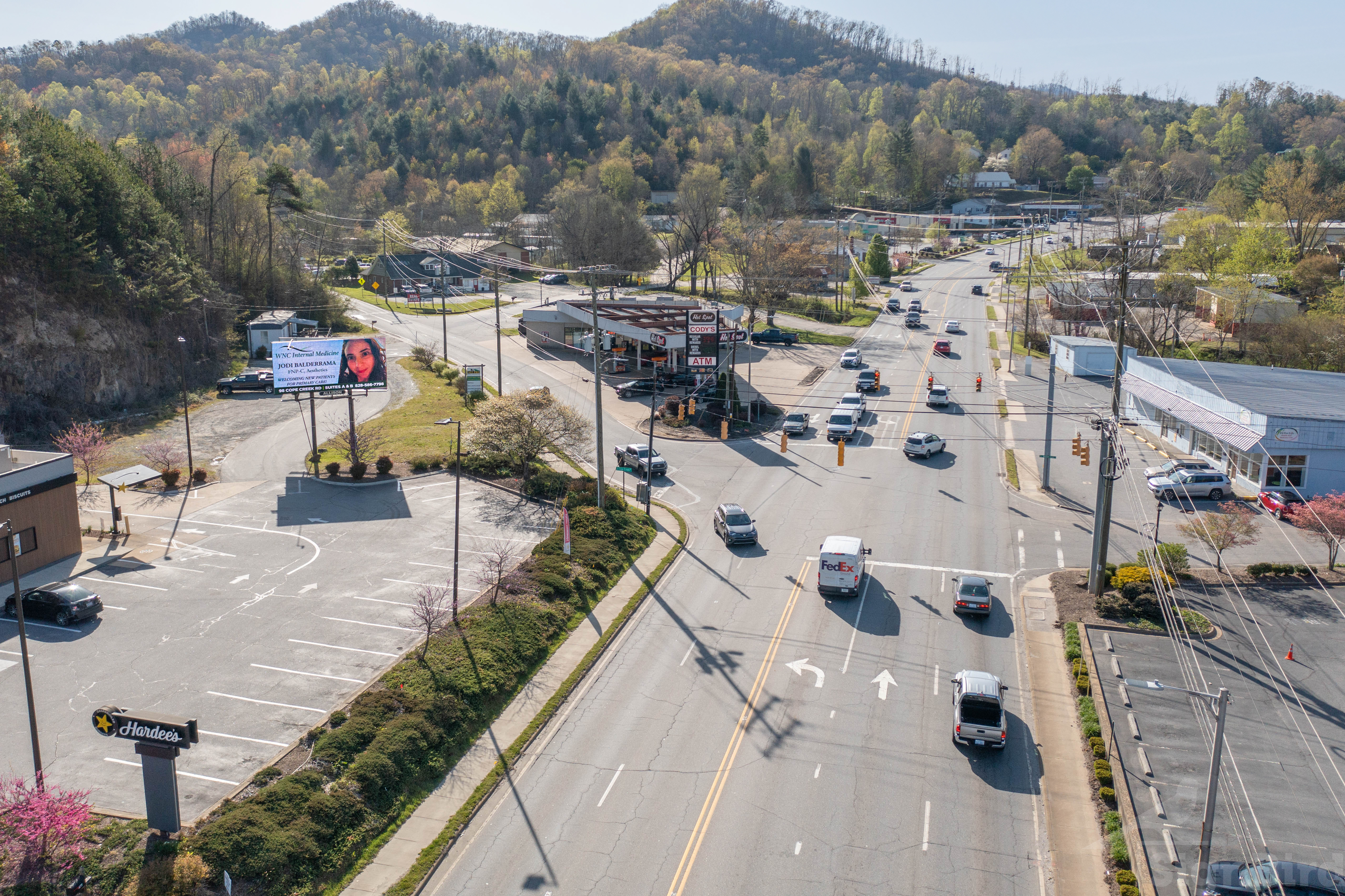
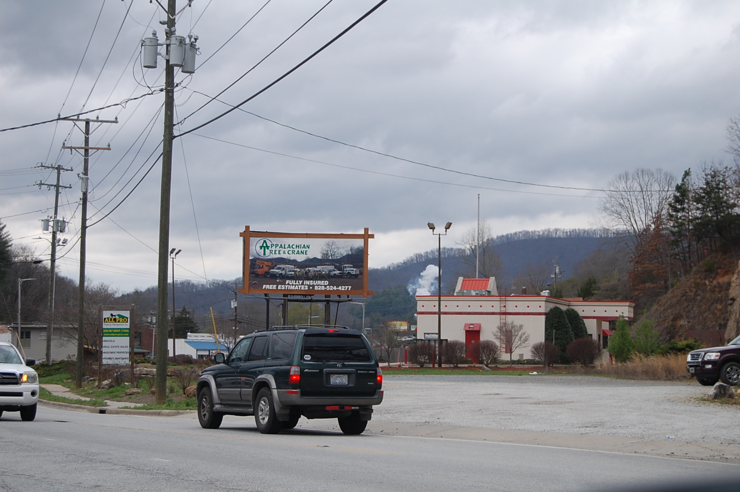
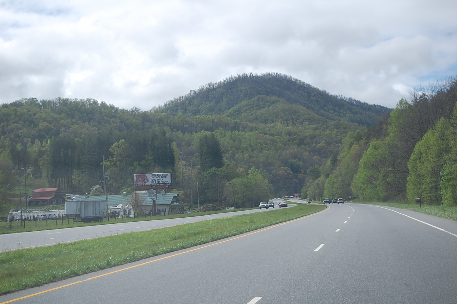
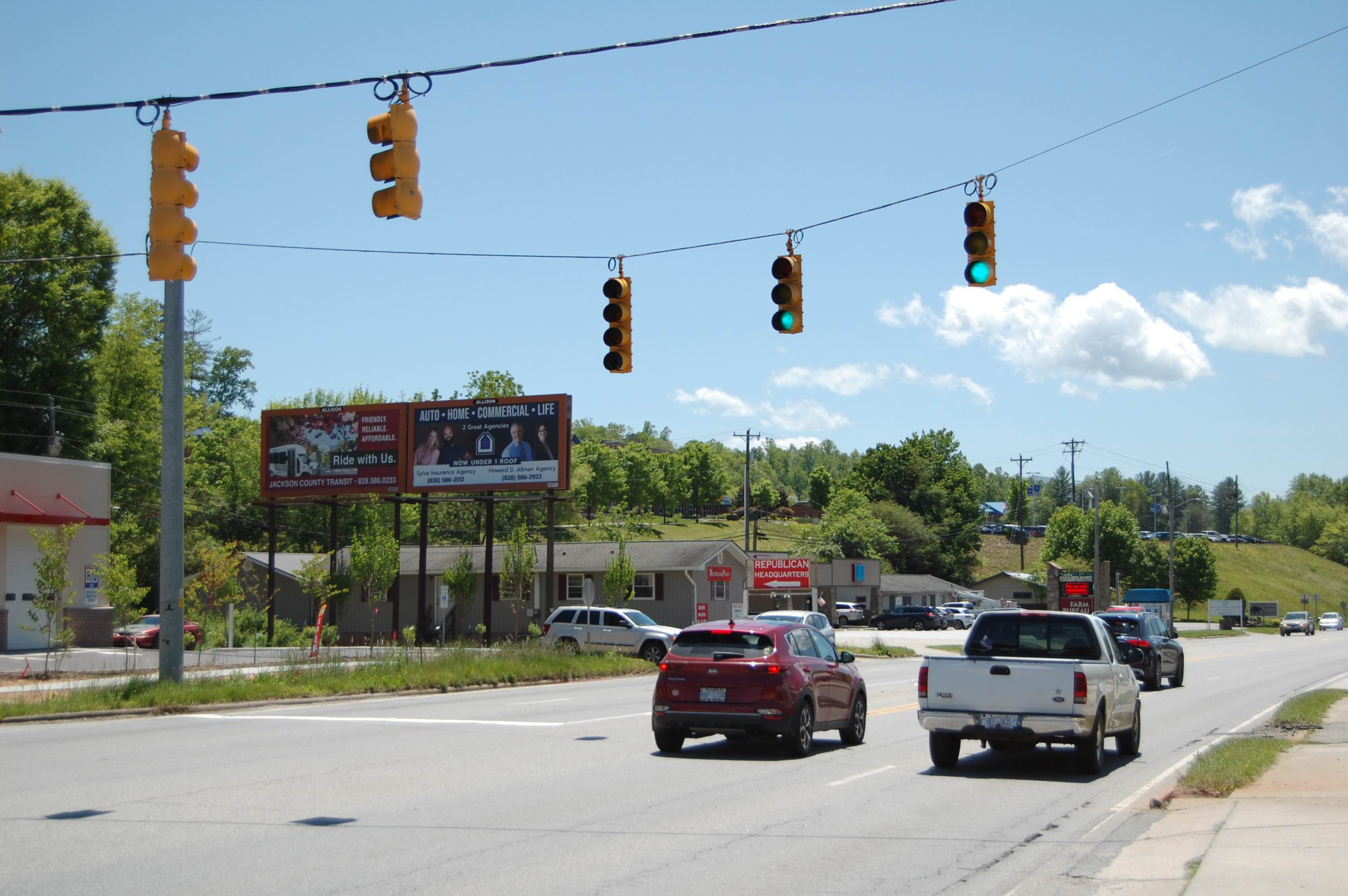
Intersection of Hwy 107 and Cope Creek N/S, W/F In The Heart of Hwy 107 in Sylva. This board is viewed at a Stop Light in Slow Moving traffic at the Hardee's. The Board is seen to all travelers heading towards Wal-Mart, Ingles, Lowes, Smoky Mtn HS, Southwest Community College and Western Carolina University.

SYL-3396-W.1

SYL-3396-W.1

SYLVA

Lat

35.371367

Long

-83.20487

Size:

10'5x22'8

Wkly DEC:

154560

Notes:

Intersection of Hwy 107 and Cope Creek, E/F Seen coming from Cope Creek to Hwy 107

SYL-3316-N-1.1

SYL-3316-N-1.1

SYLVA

Lat

35.312989

Long

-83.26036

Size:

12'0x24'0

Wkly DEC:

67620

Notes:

E/S US 441 Across from Cabe Road, S/F At Savannah Farms Nursery

SYL-3316-N-2.1

SYL-3316-N-2.1

SYLVA

Lat

35.312989

Long

-83.26036

Size:

12'0x24'0

Wkly DEC:

67620

Notes:

E/S US 441 Across from Cabe Road, S/F At Savannah Farms Nursery

SYL-3316-N-3.1

SYL-3316-N-3.1

SYLVA

Lat

35.312989

Long

-83.26036

Size:

12'0x24'0

Wkly DEC:

67620

Notes:

E/S US 441 Across from Cabe Road, S/F At Savannah Farms Nursery

SYL-3316-S.1

SYL-3316-S.1

SYLVA

Lat

35.312989

Long

-83.26036

Size:

10'0x30'0

Wkly DEC:

44100

Notes:

E/S US 441 Across from Cabe Road, N/F At Savannah Farms Nursery

SYL-3437-E.1

SYL-3437-E.1

SYLVA

Lat

35.427054

Long

-83.103826

Size:

10'5x22'8

Wkly DEC:

66150

Notes:

W/S US 19 N 6.9 Mi N/O Cope Creek, W/F At Balsam Fire Department

SYL-3437-W.1

SYL-3437-W.1

SYLVA

Lat

35.427054

Long

-83.103826

Size:

10'5x22'8

Wkly DEC:

66150

Notes:

W/S US 19 N 6.9 Mi N/O Cope Creek, E/F At Balsam Fire Department

SYL-3409-EI.1

SYL-3409-EI.1

SYLVA

Lat

35.356611

Long

-83.200364

Size:

10'5x22'8

Wkly DEC:

103950

Notes:

N/S SR 107 0.15 Mi W/O SR 117, W/F, Right Below Smoky Mtn High School

bottom of page